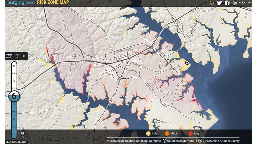
Climate Central has released a new module within Surging Seas Risk Finder, their interactive data toolkit for the coastal United States. Climate Central plans to expand the toolkit internationally in 2017.
"Coastal Floods Are Increasing" uses analysis from a report quantifying the contribution of human-induced sea level rise to “minor” floods as defined by the National Weather Service. These are the increasingly frequent events that can block traffic, degrade infrastructure, and cause a multitude of problems in daily life, even on sunny, storm-free days. The tool charts trends for places within 100 miles of tide gauges analyzed in the study.
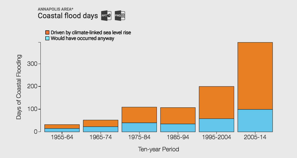
Two-thirds of all floods in the U.S. since 1950 — and more than 75% in the last decade — are directly attributable to sea level rise caused by the burning of fossil fuels. Here’s an example from Risk Finder of the decade-by-decade look for Annapolis, MD.

Image courtesy of Climate Central
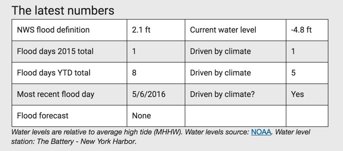
The toolkit also provides an up-to-date tally of the flooding that’s occurred since the beginning of 2015, based on localized data from 27 tide stations. The example below is for New York City.

Image courtesy of Climate Central
To explore the risk for your area, searching for your location at riskfinder.org.


