The Indian River Lagoon (IRL) is a complex estuary home to a robust quantity of aquatic and coastal species in Eastern Florida. Spanning over 2,000 square miles, the estuary is made up of three sections: Mosquito Lagoon, Banana River, and the Indian River. The IRL is split between the temperate and tropical climates zones, making it a unique region for biodiversity of aquatic species.
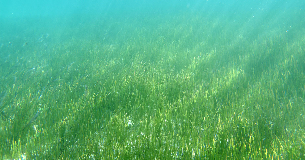
The IRL is known mainly for its seagrass-based ecology. Seagrass beds are community environments made up of aquatic, flowering plants that host a series of other species in the habitat they create. For decades the seagrass ecosystem flourished and supported successful commercial fisheries and aquatic recreational tourism. However, in recent years, the IRL has experienced a continued loss of seagrass following what some call a “regime shift”—more specifically the ecosystem transitioned from a seagrass dominated habitat to an algae dominated one.
A heat map showing final total suitability values for seagrass transplantation site selection for the north range (from north to south) of the Indian River Lagoon. (Image credit: CSA)
The large decrease in seagrass ecosystems—from a once flourishing 80,000 acres to 20,000 acres, as reported by the South Florida Water Management District in 2021—has sparked series of marine environmental research studies and strategies. To better understand what has driven the decrease in overall seagrass coverage and determine ways of improving the habitat private, public, and governmental projects have launched to research the impacts of water quality, light, circulation, nutrients, temperature, and more.
With the goal to increase seagrass coverage and restore bioproductive habitat in the IRL, applied marine science practitioners along the IRL have begun experimental and widespread restoration projects. Determining the placement and location of such seagrass restoration projects is no easy task, but what if there was a tool that could guide restoration practitioners toward the best possible success?
Public Risk Assessment Tool
To guide seagrass restoration efforts, CSA Ocean Sciences (CSA), contracted under Ecological Associates, Inc. (EAI), collaborated with scientists in Brevard County Natural Resources Management and St. Johns River Water Management District (SJRWMD) to develop a geospatially registered risk assessment model in ArcGIS for Brevard County to employ.
Estuarine environmental variables—provided by SJRWMD, Applied Ecology under contract with Brevard County, and CSA—were used to determine the feasibility for seagrass survival. Salinity, temperature, chlorophyll, dissolved oxygen, bathymetry, and past seagrass distribution data were all considered when determining the relative risk for seagrass restoration. Environmental data for each variable were divided into levels of risk and assigned risk rankings. The sum of risk rankings for all variables was output by the model to help inform restoration decisions. Risk rankings ranged from 6 (High Risk – Low Suitability) to 18 (Lowest Risk – High Suitability; see Figures A, B, and C for an application of the model running north to south through Brevard County.
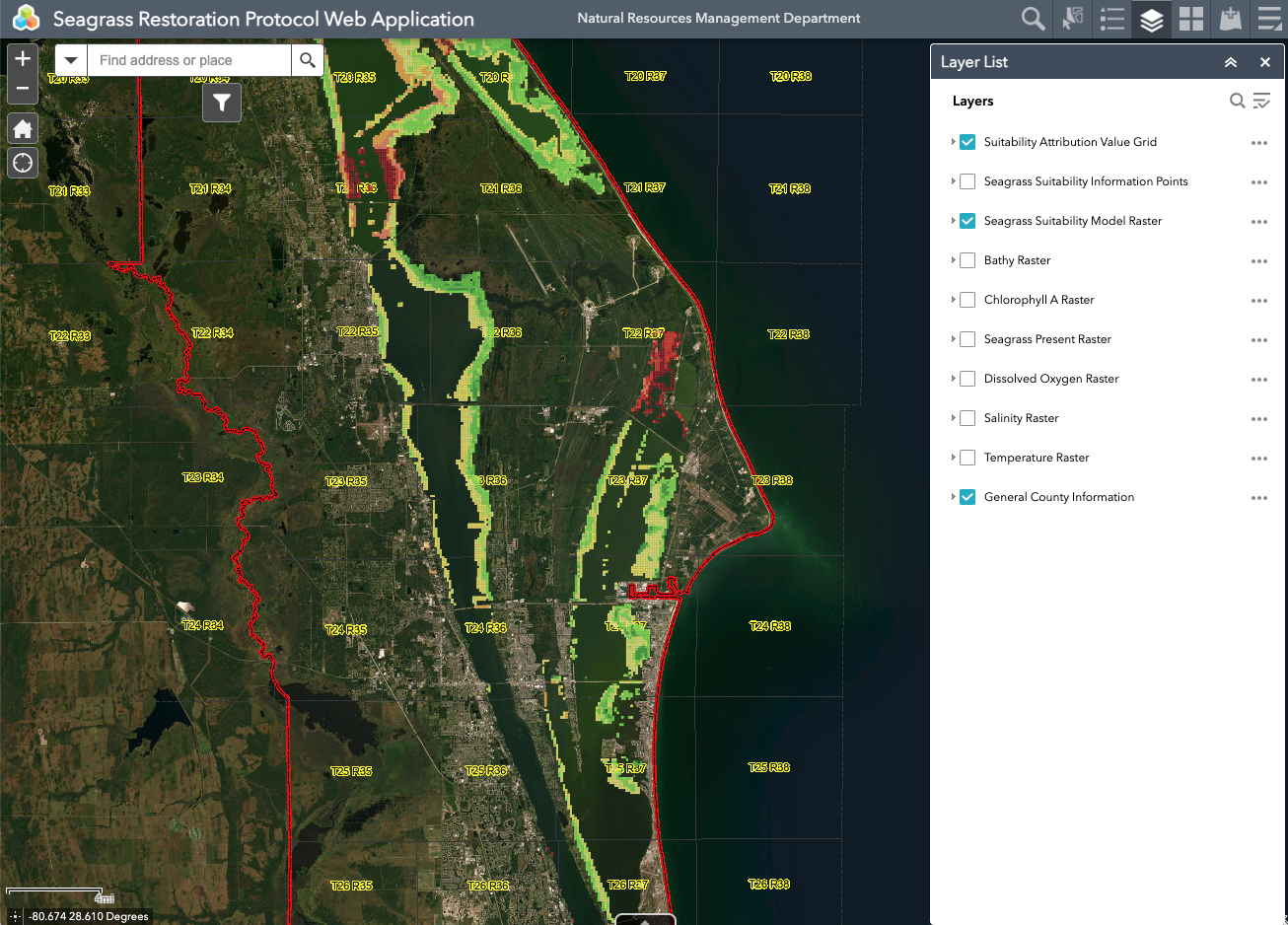
The Seagrass Restoration Protocol Web Application is publicly available online for use and layer manipulation. (Image credit: Brevard County Natural Resources Management) [https://gis.brevardfl.gov/portal/apps/webappviewer/index.html?id=4732bdd5ed724f1391bd9d521a37d653]
This model—which CSA hopes to adapt for use by other resource managers—shows those contemplating seagrass restoration in the IRL where success can be more challenging and prompts practitioners to avoid the footprints of existing long-term studies. While the risk assessment does not indicate where seagrasses can or cannot survive, it does show where multiple factors combine to indicate an increased risk of restoration failure.
The risk assessment model should guide seagrass restoration practitioners to tamper efforts in areas of increasing risk. Outside of just the model, a ‘Plan-Act-Monitor-Learn’ cycle of management was also developed, in which seagrass transplants are placed in experimental units and tested based on a series of scientific questions.
To foster adaptive management, the model can be upgraded over time with updated or additional ArcGIS data layers for water quality, bathymetry, other environmental data, or restoration-success data to improve overall risk forecasting for seagrass restoration projects.
Virginia Barker, Director of Natural Resources Management for Brevard County, adds, “This seagrass restoration tool supports a science-based decision-making process for practitioners and managers to minimize risk and improve the likelihood of project success. Not only does this risk assessment model provide guidance using the best available current data, but its web-based platform allows new or updated geospatial data layers for variables of interest to be incorporated making this an adaptive, customizable, and easy to access tool for any restoration project.”
Driving Success
Collaborative research-based projects have the ability to improve marine environments and increase the health of ecosystems supporting fisheries, ecotourism, and more. Tools like this risk assessment model—supported by robust, accurate data sets—can guide subject matter experts to make the best educated decision on where to begin restoration projects and possibly more importantly, where not to.
To learn more about CSA and their GIS capabilities, visit: https://www.csaocean.com/services/edgs
This feature appeared in Environment, Coastal & Offshore (ECO) Magazine's 2023 Deep Dive II special edition Marine Environmental Research, to read more access the magazine here.
