")
Scientists have known for more than 50 years that the release of carbon dioxide (CO2) gas from burning fossil fuels by humans can have harmful consequences for the planet. Most of the concern has centered on global warming due to the greenhouse effect. Twenty years ago, another impact of this global increase in CO2 was first characterized as ‘ocean acidification’ (OA), caused by the dissolution of CO2 from the atmosphere into the ocean. This process leads to a lowering of the water's pH, making the ocean more acidic. OA is expected to have negative effects on many marine species, alter marine food chains and food supply to humans, decrease storm protection from reefs, and impact tourism. More recently, ‘coastal acidification’ (CA) has been identified as another mechanism by which the chemistry of coastal waters can change. Important divers of CA acidification include anthropogenic eutrophication (human-caused elevations in nutrients, e.g., nitrogen, phosphorous), freshwater inputs, and upwellings.
Introducing IRLON
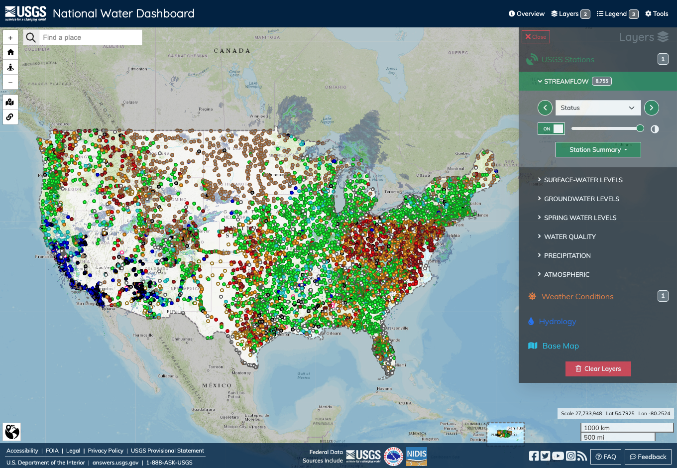
In 2013, we launched IRLON (The Indian River Lagoon Observatory Network of Environmental Sensors), an estuarine observation and prediction network in the Indian River Lagoon (IRL) and St. Lucie Estuary (SLE) that provides real-time, high-accuracy, and high-resolution water quality and weather data through a dedicated interactive data portal (www.irlon.org). We initially built the water quality analytical capabilities with Land/Ocean Biogeochemical Observatory (LOBO) technology, developed by scientists and engineers at the Monterey Bay Aquarium Research Institute (MBARI). In 2020, the IRLON team modified the original LOBO technology to develop IRLON Biogeochemical Instrument Packages (BIPs), which included improved data loggers and telemetry capabilities.
IRLON stations are strategically located to monitor the dynamic interface between oceanic water from the inlets with freshwater inputs from rivers, canals, and Lake Okeechobee. (Image credit: IRLON, FAU Harbor Branch)
Expanding Observations in the IRL
During 2020-2022, we added new technical capabilities to existing IRLON sites to address emerging issues of IRL health, including CA. Pro Oceanus CO2-Pro CVs measure pCO2, a measure of the partial pressure of carbon dioxide, which, when coupled with IRLON’s SeaFET pH capabilities, allows calculation of the remaining carbonate system parameters, including aragonite saturation, an important component in CA. In addition to the new sensor, three new stations were deployed in the northern IRL, making IRLON truly a lagoon-wide monitoring network.
Our initial pCO2 data indicate that there are huge differences among our stations. pCO2 levels at IRL sites near the inlets are lower than the much more elevated concentrations upstream in the IRL and SLE—especially at SLE-SF2—the most upstream station. pCO2 concentrations near the IRL inlets are very similar to those measured in mid-Tampa Bay, where the United States Geological Survey (USGS) operates a similar monitoring effort at one station (see:http://tampabay.loboviz.com/). Interestingly, within the SLE, there is a large increase in pCO2 a short distance upstream where salinity is lower and organic matter, nitrogen, and phosphorus is elevated.
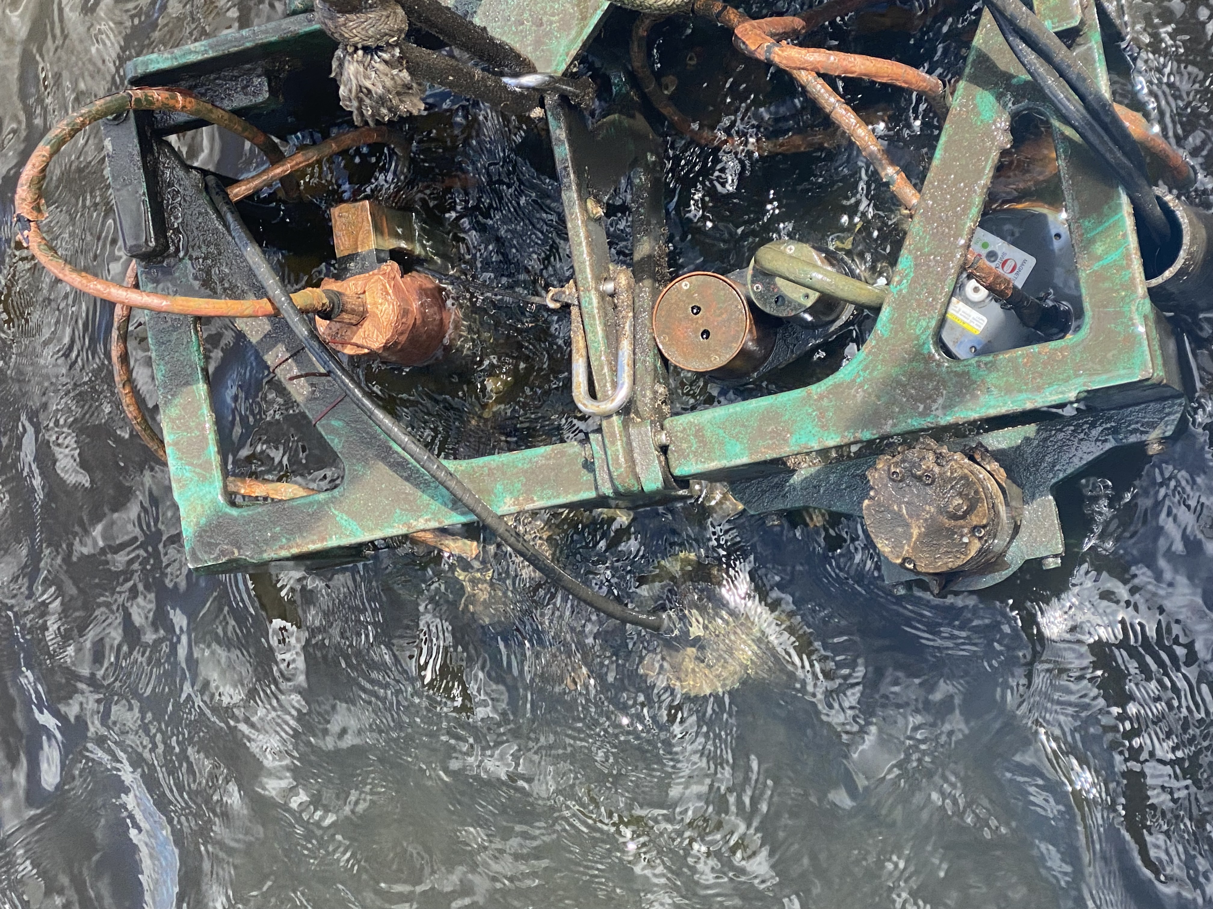
The protective IRLON instrument cage contains a suite of underwater sensors that measure important chemical, physical, and biological water quality parameters one meter off the bottom. (Image credit: IRLON, FAU Harbor Branch)
There is also a large amount of temporal variation in pCO2 among stations. This variation is influenced by several other parameters. In the dry season (November to April), physical control is primarily driven by temperature and then by salinity. Biological control of pCO2 is also evident, based on IRLON’s dissolved oxygen and pH data. The drivers for the wet season are more complicated, which we plan to tease out as we recieve additional data.
We can now also estimate another important CA parameter—aragonite saturation state (ΩAr)—from our IRLON data. When ΩAr exceeds 1, calcifying organisms (e.g., corals, shellfish, certain algae) are at risk for decalcification. Our IRLON data show considerable spatial and temporal variability in these important measures of coastal acidification, which is exacerbated by storms and freshwater runoff. Calcifying organisms are at risk of CA, at least in certain locations, at certain times. Our first full year of data, completed in December 2022, shows periods of low pH, elevated pCO2, and ΩAr <1, indicating that dissolution of carbonate organisms (e.g., clams, oysters) is likely; the driver for this is high runoff related to storms. In the coming year, we will implement a real-time, estimated aragonite saturation state calculation so that this information will be disseminated immediately to our stakeholders via our IRLON data portal.
Unparalleled Real-Time Observation
These types of continuous monitoring data enable us to better understand and quantify relationships between environmental factors and various processes and estuaries. This technology is wonderful; while challenging, it will enable all of us to identify and better understand long-term ecosystem changes that are driven by events such as freshwater discharges, drought, storms, algal blooms, and CA.
In particular to CA, all marine plants and animals in our estuaries will be impacted to some degree. There will be ‘winners’ and ‘losers’. Coastal ecosystem services will be severely impacted, and the greatest at risk are calcium carbonate-producing organisms. Some current restoration efforts (especially shellfish restoration) are vulnerable to CA. Thus, it is critical to better monitor CA in estuaries and other coastal waters to help inform policymakers, resource managers, and shellfish aquaculturists.
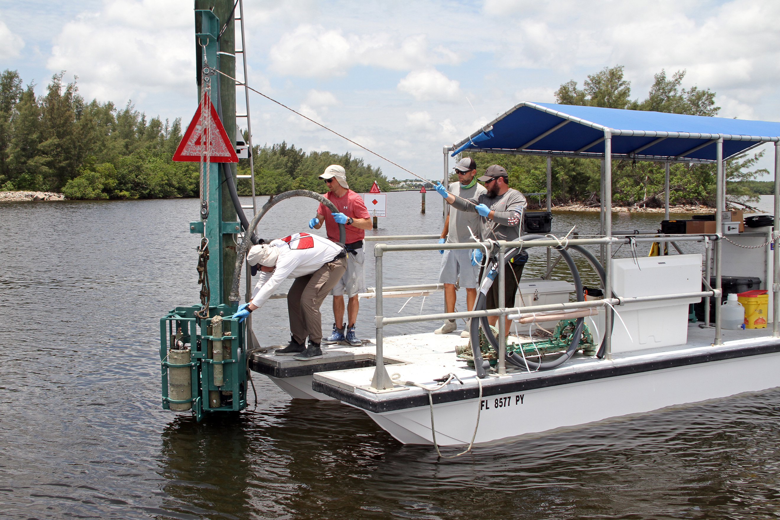
Deployment of the IRLON instrument cage at station IRL-LP, which is located just outside the Harbor Branch Channel in the IRL. (Image credit: IRLON, FAU Harbor Branch)
IRLON provides researchers, governmental agencies, students, and the public with unprecedented, real-time environmental data. In addition to enabling researchers to follow environmental changes in this unique estuarine system and assist resource and planning managers in making informed decisions, IRLON data are also increasingly being used to assist in planning and monitoring IRL restoration efforts.
In summary, estuaries, such as the IRL and SLE, are threatened by CA. Networks of environmental sensors such as IRLON that measure key CA parameters are necessary so that we can detect real trends in CA, guide management efforts to identify impacts of CA, and facilitate possible mitigation strategies (e.g., reduction of freshwater runoff, seagrass restoration).
To access IRLON’s real-time data portal, visit: irlon.org
This feature appeared in Environment, Coastal & Offshore (ECO) Magazine's 2023 Deep Dive I special edition Ocean Observation, to read more access the magazine here.
