The Intergovernmental Panel on Climate Change’s 6th Assessment Report estimates that for the remainder of this century sea levels will continue to rise, leading to increasingly frequent and severe flooding in coastal areas.
The magnitude of risks associated with these projections is staggering when you consider that nearly 40% of the global population lives within 100 km of a coastline and 10% of people worldwide live in coastal areas that are less than 10 m above sea level (McGranahan et al 2007). In addition to these population-based vulnerabilities, about 5% of the world’s economy is driven by trade in ocean-based goods and services. The takeaway? What impacts the coasts, impacts us all.
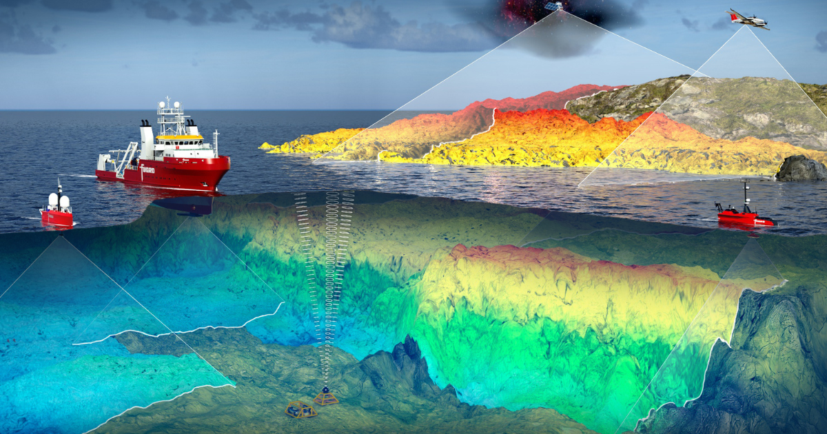
Comprehensive Geo-data for coastal environments—including topobathymetric maps and ocean observations—are critical to understanding the risks associated with climate change and sea level rise. That’s why government agencies large and small are urgently developing coastal resilience strategies that include Geo-data acquisition, delivery, and maintenance. It’s these programs that will enable communities to effectively plan, monitor, and act in support of safe and resilient coasts.
Coastal Resilience Starts with a Map
Coastal environments are complex and dynamic open systems and since a wide variety of human-centric activity takes place along shorelines, coastal Geo-data needs are diverse. Coastal mapping makes it possible to acquire, analyze, and advise on the physical characteristics of the coastal landscape, both above and below the water with Geo-data.
Historically, this work has been the remit of national hydrographic offices whose work is largely focused on maritime transportation safety and efficiency. The private sector is often called on to support these efforts. When partnership is prioritized in these contracting relationships, national hydrographic offices have shown to be a catalyst for advancing new technologies and techniques that deliver safer, more efficient, and more sustainable coastal mapping solutions.
The United Kingdom Hydrographic Office (UKHO) exemplifies this concept. Responsible for delivering hydrographic and marine Geo-data to mariners and maritime organizations in the UK and abroad, UKHO requires contractors to measure and report social values including, environmental benefits. In line with these objectives, Fugro last year performed a carbon neutral survey for UKHO in the Cayman Islands.
That feat was accomplished in part by using Fugro RAMMS, a next-generation airborne lidar mapping system that was initially inspired by UKHO challenging industry to improve the efficiency of lidar bathymetry surveys and quality of lidar bathymetry data. Fugro has gone on to further reduce emissions associated with lidar acquisition by developing the capability to deploy the RAMMS system from fixed and rotary wing uncrewed aerial systems (UAS). The system can even be deployed from a vessel of opportunity, enabling it to access more remote and challenging locations typical of many coastal areas.
Observational Geo-data Add Depth
Characterizing the coastal zone is more powerful when coastal mapping is combined with additional observational Geo-data, such as tidal, current, wave, biogeochemical, and environmental data for the ocean and coastal environment.
Physical ocean properties play a large role in understanding how storms and other ocean and climate-related phenomena interact with the coastline. Monitoring fluctuations in these observations can provide a time element, thus informing on which resilience efforts should be considered and whether they are likely to be effective in the longer term. On a broad scale, scientists use these data to run and validate models of climate change’s role—such as sea level rise—on a particular location, including impacts to the local environment. Consulting scientists and engineers assess these data, along with other factors, in developing and designing resilience strategies.
You can find the rest of this feature in ECO Magazine’s Winter 2022 Issue—Resilient Coasts. To read more, visit: http://digital.ecomagazine.com/publication/?i=771295&p=10&view=issueViewer.


