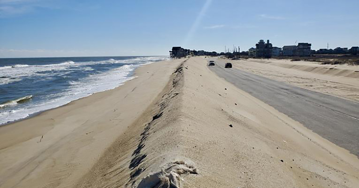
Researchers in North Carolina have created a simulation model to analyze how coastal management activities meant to protect barrier islands from sea-level rise can disrupt natural processes that are keeping barrier islands above water.
“Coastal management strategies intended to protect people, property and infrastructure from storm impacts can, over decades, increase vulnerability, even leading to the loss of barrier islands, especially as sea-level rise rates increase,” said A. Brad Murray, professor of geomorphology and coastal processes at Duke University’s Nicholas School of the Environment.
He and other researchers in North Carolina created a computer model that simulates dynamics of barrier island systems over the next two centuries, showing how natural processes that create and maintain these systems affect communities and infrastructure, and how human efforts to protect communities and infrastructure, in turn, affect those natural processes. They published a pair of studies on the work in Earth Futures.
Barrier islands are narrow offshore landforms that run parallel to the mainland coastline. These are dynamic features, naturally gaining elevation and migrating landward as sea level rises or sediment supply dwindles. Barrier islands absorb wave energy before waves hit the mainland, which can lessen coastal storm surge and flooding. The United States has the greatest extent of barriers worldwide, stretching across much of the Southeast and Gulf of Mexico.
Coastal communities on barrier islands, which have long grappled with eroding shorelines and coastal storms, now face substantial sea-level rise due to climate change. They are already encountering increased risks of coastal flooding and threats to critical infrastructure.
Many of these coastal communities rely on federally subsidized “beach nourishment”—the artificial widening of beaches with sand—or engineered solutions, such as the construction of artificially high dunes, to adapt to changing climate threats.
Some solutions, however, interrupt natural processes that have kept barriers above sea level.
Sand deposited on these islands when storm waves knock down dunes is essential to maintain barriers’ width and elevation. But on developed barriers, storm fallout—including overwashed sand on roads—are hazards.
“Counterintuitively, the more successful humans are in preventing storm impacts, the less resilient the barrier system becomes in the long term,” said co-author, Laura Moore, professor of coastal geomorphology at the University of North Carolina at Chapel Hill. “Difficult tradeoffs are going to be inevitable when it comes to managing the coast with the hope of preserving coastal living as we know it.”
The researchers’ modeling demonstrates that how long a barrier remains habitable varies with different coastal management strategies and climate scenarios.
For example, the model showed that shifting away from the practices of protecting roads with tall dunes and bulldozing over washed sand off paved surfaces may allow barriers that would have become uninhabitable to rebound and keep up with sea level rise longer.
Adopting management strategies that allow one segment of the shoreline to evolve naturally—such as building a long bridge to replace part of a highway—can increase the barrier system’s resilience in that area. However, management strategies in one area affect erosion rates in adjacent areas.
Increasing long-term resilience in one area can come at the cost of higher shoreline stabilization costs for neighboring communities. Given these connections along the shore, stakeholders in neighboring coastal areas may benefit from collaborating, the authors noted.
“There’s no perfect solution,” said the study’s lead author, Katherine Anarde, assistant professor of coastal engineering at North Carolina State University. “Understanding an entire barrier system and how it responds to different coastal management decisions is critical to assessing the sustainability of coastal development over the coming decades. The model helps us consider several factors in managing coastal areas to ensure we’re not unintentionally making things worse in the long run, and to weigh the tradeoffs.”
The National Science Foundation, University of Virginia, and the Gulf Research Program Early-Career Research Fellowship co-funded this study.


