On Tuesday, March 26, 2024, the 984-foot M/V DALI collided with the Francis Scott Key Bridge near Baltimore, Maryland, sending the bridge tumbling into the Patapsco River, resulting in the tragic loss of six construction workers, and triggering a local, state, and federal response. Large sections of the bridge’s structure lay across the main shipping channel into the Port of Baltimore closing the deepest shipping lane into and out of the port and resulting in an estimated loss of $15 million in daily economic activity for the area. All shipping traffic was diverted from the area, enabling first responders to conduct high-priority rescue and recovery operations, and allowing highly trained salvage crews to begin the arduous task of removing bridge wreckage. Due to the amount of debris in the water, it was evident that salvage operations would take some time, and the priority at the time was to open the port for at least some vessel traffic.
Establishing The First Navigation Channels (March 29 to April 3)
Several NOAA programs supported and collaborated with the Port of Baltimore, the US Coast Guard, the US Army Corps of Engineers Baltimore District, and other partners to help establish auxiliary navigation channels and restore limited vessel traffic through this important waterway. The auxiliary channels would serve as alternate routes for shallow-draft vessels to pass around the wreckage of the Francis Scott Key Bridge via the undamaged bridge spans on the north and south sides of the main shipping channel.
NOAA’s Office of Coast Survey deployed six personnel to the scene, including the mid-Atlantic navigation manager and a combined team from the NOAA navigation response team—New London, NOAA R/V Bay Hydrographer II, and NOAA Ship Ferdinand R. Hassler. On Sunday, March 31, the team completed high-priority survey operations on the channel’s north side using multibeam and side-scanning sonar to determine water depths, detect obstructions along the river’s bottom, and establish available air drafts and widths between the remaining bridge abutments. This data was paired with additional vessel based lidar data delivered by the Office of Coast Survey to provide the distance between the water and non-collapsed sections of the bridge.
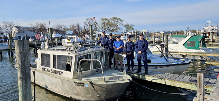
The survey team in Baltimore. From left to right, Michael Bloom (Physical Science Technician, Navigation Response Team – New London), LT Patrick Debroisse (Ops Officer, NOAA Ship Ferdinand R. Hassler), Rob Mowery (Physical Science Technician, R/V Bay Hydro II), LTJG Carly Robbins (OIC, R/V Bay Hydro II), LTJG Mark Meadows (OIC, Navigation Response Tea – New London). Not pictured, but also on scene for the response: LCDR (ret) Ryan Wartick (NOAA Mid-Atlantic Navigation Manager). (Image credit: RDML Benjamin K. Evans/NOAA)
Using NOAA’s survey data, the US Coast Guard opened the first of two temporary alternate channels: Sollers Point Alternate Channel and Hawkins Point Temporary Alternate Channel. Upon completion of survey operations, NOAA’s Office of Coast Survey integrated the data into the electronic navigational chart. The revised chart, which includes both temporary alternate channels, bridge features and clearances, and newly placed aids to navigation, was made publicly available on Wednesday, April 3.
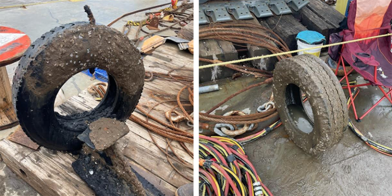
An image of obstructions found and removed in Hawkins Point Channel (left) and Sollers Point Channel (right) during the Francis Scott Key Bridge response. (Image credits: LTJG Mark Meadows/NOAA)
Establishing Deeper Channels (April 17 to Present)
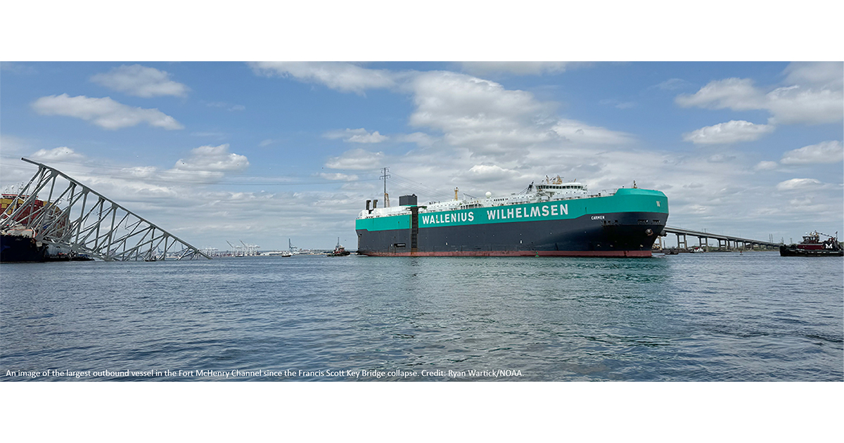
The NOAA navigation response team returned to Baltimore on April 17 and has been intermittently and iteratively conducting additional multibeam sonar surveys to create high resolution bathymetric maps of the increasingly deeper channels as the salvage teams work to remove materials. The navigation response team continues to identify obstructions to safe navigation in the high-resolution sonar data and provide maps to the command center within hours of acquisition. For example, these maps have helped the US Army Corps of Engineers and their contractors remove the obstructions, and the US Coast Guard select locations to place temporary buoys to mark these channels. The NOAA team is continuously re-surveying until all obstructions are removed and the channels are safe for navigation to the advertised depths within the established areas. The Fort Carroll Temporary Alternate Channel cleared to 20-feet was first opened April 20 and the Fort McHenry Limited Access Channel cleared to 35-feet was opened April 25.
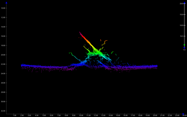
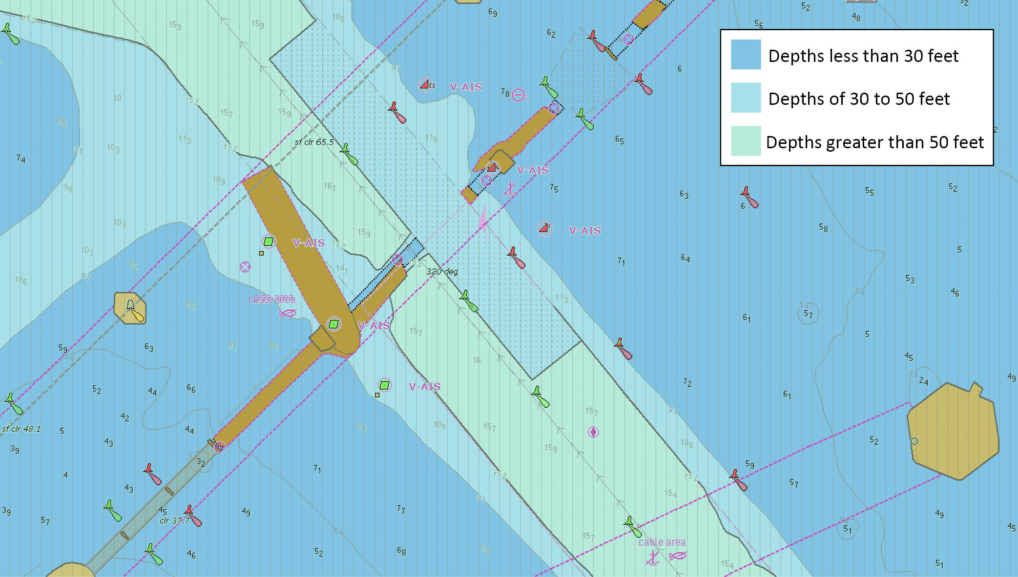
A NOAA graphic showing an obstruction found in the Fort Carroll Alternate Channel, developed with a multibeam echosounder. (Image credit: NOAA)
Once all obstructions have been cleared from the channel, the Office of Coast Survey’s Hydrographic Surveys Division is quickly reviewing and qualifying the final surveys of each channel and uploading them into the National Bathymetric Source program for rapid update of the electronic navigational charts.
Regular Electronic Navigational Chart Updates
Throughout the response, the Office of Coast Survey’s Marine Chart Division is providing timely updates to NOAA electronic navigational charts (NOAA ENC®). This started with the establishment of the initial safety zone on March 26 and will continue throughout the response effort.
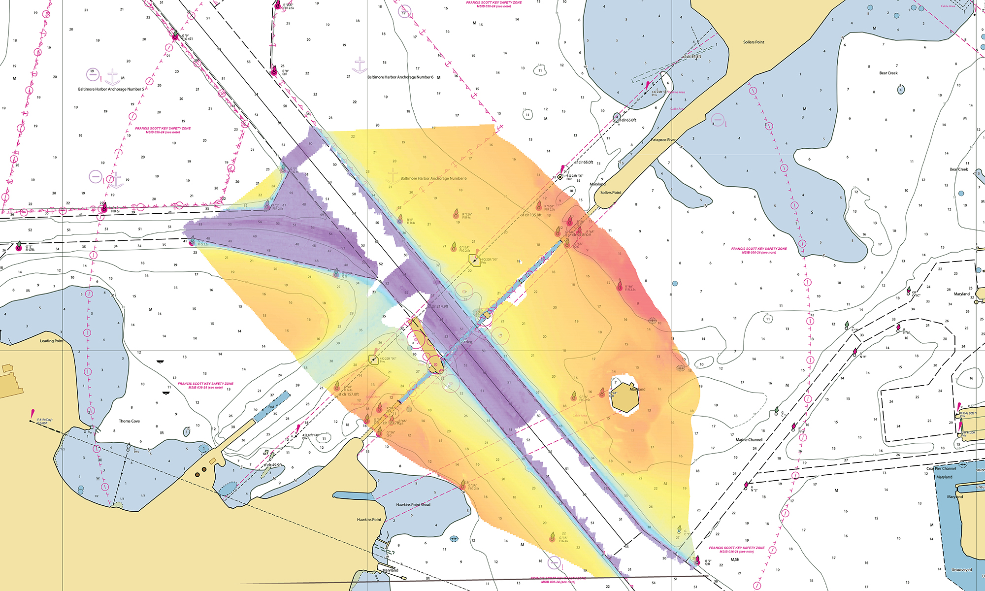
A NOAA graphic showing the nautical chart of the area surrounding the Francis Scott Key Bridge with an overlay of collected bathymetric data (April 5, 2024). (Image credit: NOAA)
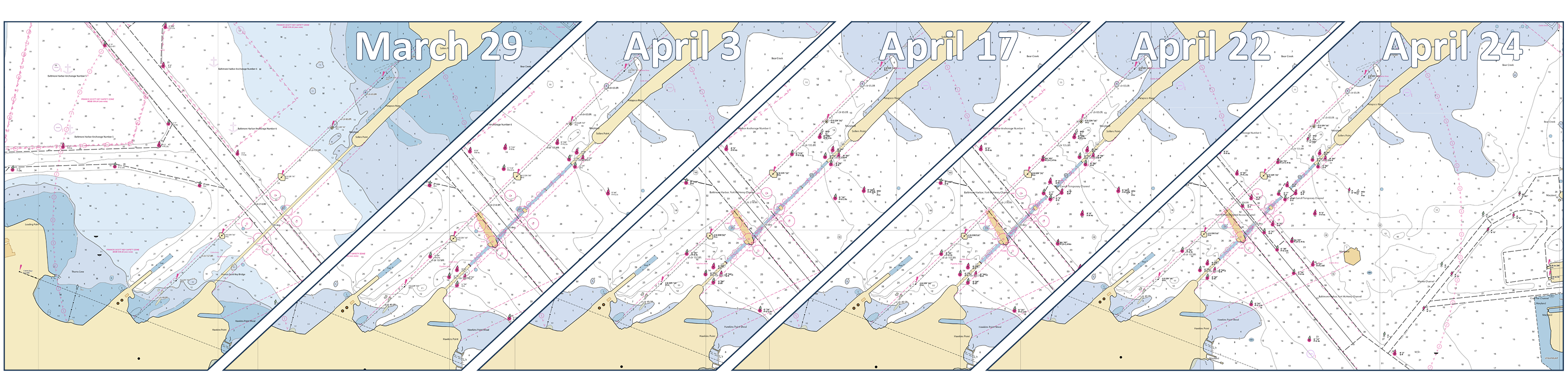
A NOAA graphic showing the nautical chart update progression of the area from March 29 to April 24, derived from the NOAA Custom Chart application. (Image credit: NOAA)
A NOAA image of the US5BALBB ENC portrayed in an electronic chart display and information system showing the remains of the bridge span, main channel, and temporary channel along the northeast edge. (Image credit: NOAA)