")
INFOMAR, Ireland's national seabed mapping program, is pleased to announce the release of its latest data update. This release encompasses essential enhancements including updated bathymetric & backscatter surfaces reflecting new specification, higher resolution, increased spatial availability and improved stability.
A key feature of data updates includes the availability of 2 m resolution survey leg data, as well as 5 m, 10 m, and 25 m resolution merged surfaces for bathymetry along with 40 m resolution data for backscatter, covering the Irish offshore and shelf areas. All bathymetric & backscatter datasets are now available in 3-star open standard format which improves user access across all GIS environments.
Thomas Furey, joint program manager at The Marine Institute, highlighted the importance of the new data release—“This valuable update marks a significant stride in providing comprehensive and up-to-date information on Ireland's seabed, crucial for various marine-related activities, including navigation, resource management, offshore renewable energy and environmental conservation.”
Key Highlights of the INFOMAR Data Release:
2 m Survey Leg Data: The inclusion of newly derived 2 m survey leg data offers increased availability for the Irish inshore, with planned regular updates during the coming months.
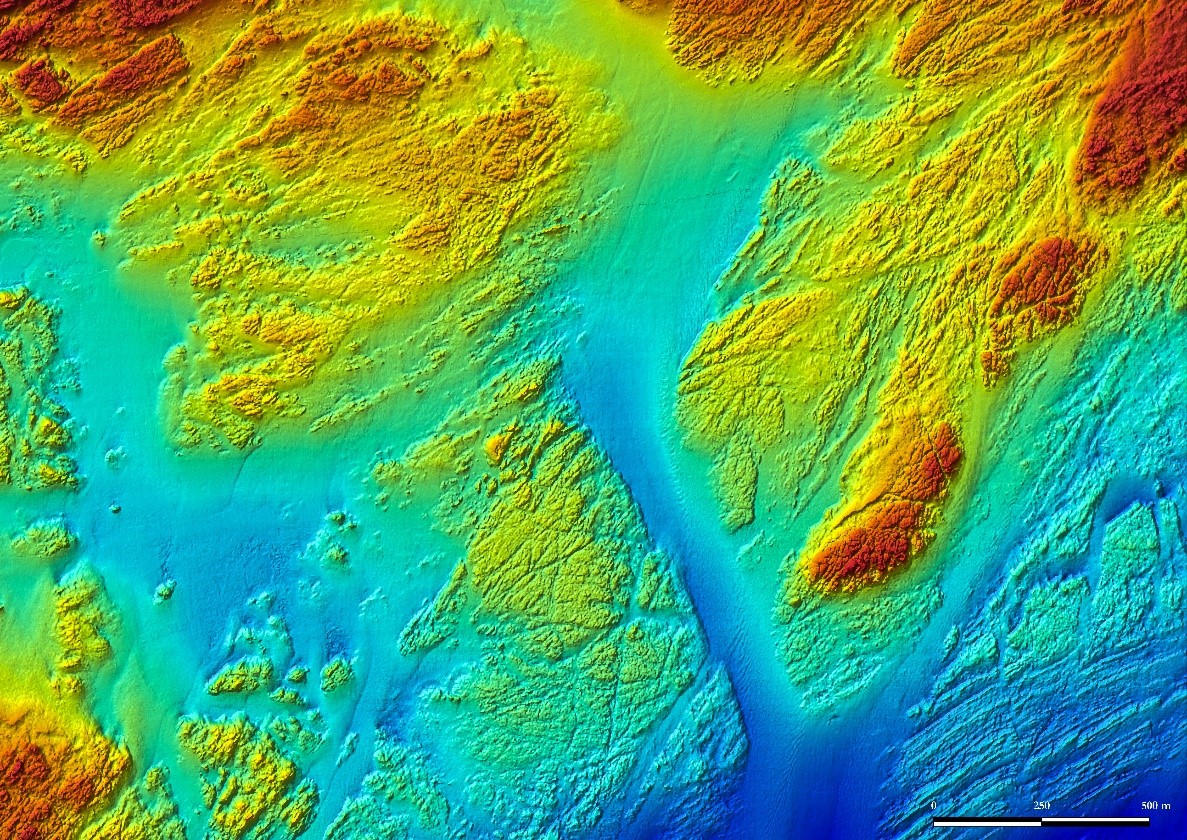 (Image credit: INFOMAR)
Merged Surfaces (Bathymetry): INFOMAR now provides merged bathymetric surfaces at 5 m, 10 m and 25 m resolutions for the Irish Shelf (0–200 m water depth). 25 m and 100 m Resolution data are also available for the Irish Offshore (>200 m water depth).
Merged Surfaces (Backscatter): A single, homogenized backscatter surface at 40 m resolution is available for the offshore, with 10 m resolution available for inshore areas.
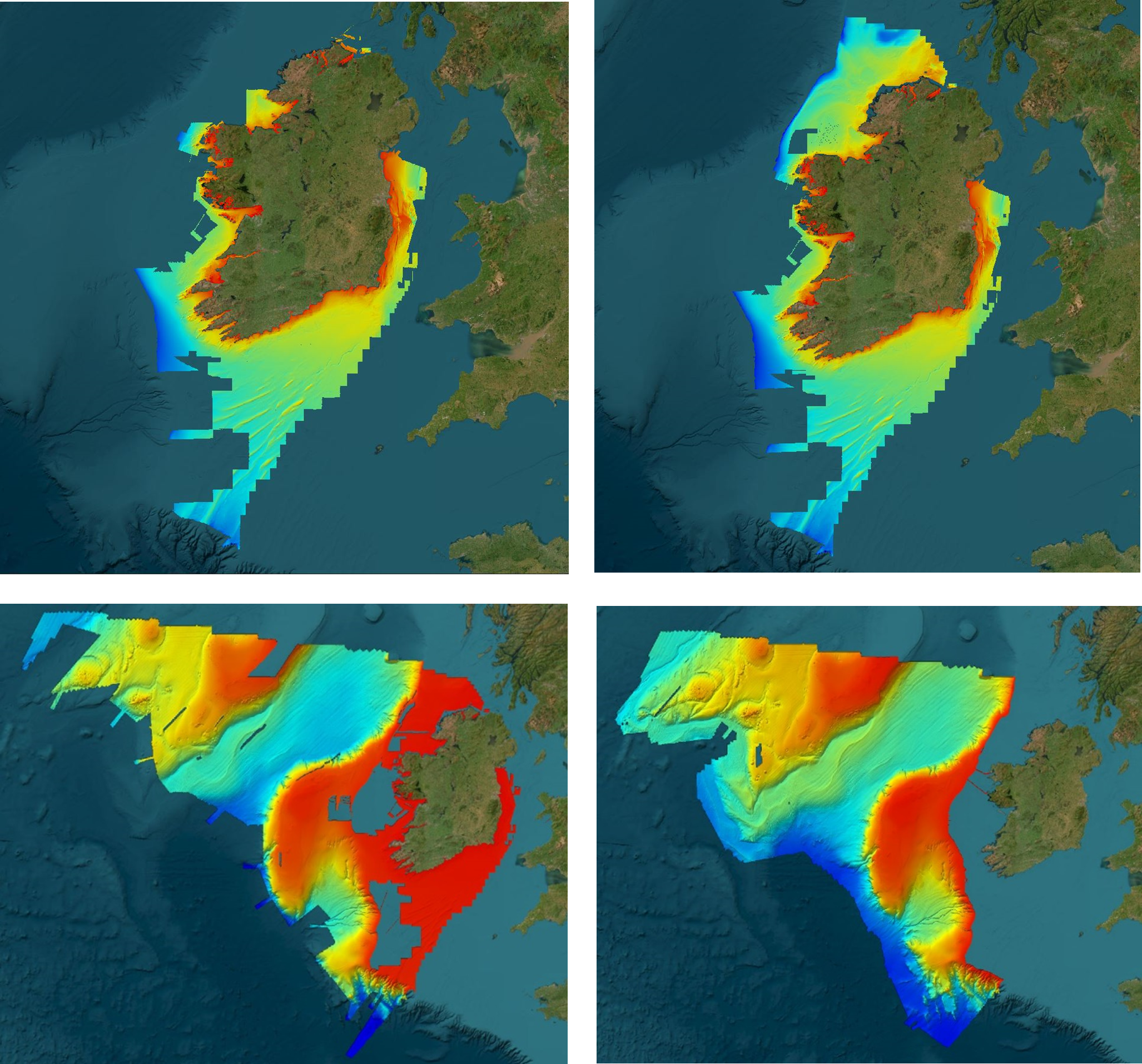 (Image credit: INFOMAR)
All data is available for download or via a data request through INFOMAR’s data download portal.
All INFOMAR Web Map Services, REST Services and bespoke viewers have been updated to reflect new data availability. INFOMAR have also updated various facets of its website to include new vector data, imagery, standard operating procedures, and value-added products. For a detailed, comprehensive overview of INFOMAR’s new data updates, click here.
Sean Cullen, join program manager at Geological Survey Ireland added that, “INFOMAR are committed to providing accurate, accessible, and up-to-date marine data to support Ireland's maritime stakeholders. INFOMAR encourages users to explore and utilize this data for scientific research, maritime planning, and decision-making processes.”
The newly updated data is readily available—free for download—at www.infomar.ie, ensuring that researchers, industry professionals, and the public have easy access to this invaluable resource.